Virtual Mine
Zbigniew J. Hladysz, Ph.D.
Professor and Chair
South Dakota School of Mines and Technology
Department of Mining Engineering
501 East St. Joseph Street
Rapid City, SD 57702-3995
USA
Phone: (605) 394-1971
Fax: (605) 394-5360
E-mail: zhladysz@silver.sdsmt.edu
ABSTRACT
The paper specifies requirements necessary to develop a smart mine design system through the application of virtual reality.
Virtual mine, presented in this paper, is a hard rock skeletal model developed using Vulcan software. The mine can be viewed and toured interactively. Relevant information about mine entities, including geology, reserves, mine openings and excavations, support systems and equipment, can be accessed at will. It provides new visualization opportunities and new communication tools for the engineers � to see their creations in 3D, students � to learn mine design, corporate managers � to see the effects of their decisions, and the public � to understand what mining is all about. Virtual mine illustrates what is presently available in mine visualization.
Virtual design paradigm, presented in the last part of this paper, is a conceptual design model that could guide the engineer in the design process through the integration of various pieces of mining software with harmony with components and systems making up the mine. Its intent is to emulate the way the engineers perform complex design tasks. Its framework is structured as a 4D fractal flowchart representing the virtual design process. This new design paradigm is an open proposition to re-engineer mine design software to address the future needs of the mining industry.
Keywords: computerized mine design, virtual reality, 3D visualization, design paradigm, Vulcan.
INTRODUCTION
Computers have been used in the mining industry since the early seventies. Early applications were not very successful due to high costs, inefficient hardware and software, the requirements of having highly skilled computer programmers and inability of software to address complex problems other than a single task. The explosion of technical computing in the early eighties brought complex software capable of addressing multiple problems and tasks, smaller and more powerful computers, and development of computing environment to a level of being cost effective.
Most technical persons are aware that computers make not only every single engineering task to be accomplished faster but also help engineers in the decision making process. Technical computing in mining requires specialized software that goes beyond spreadsheets and primitive CAD tools. Software developers are now offering numerous packages allowing engineers to solve multiple tasks utilizing interactive and graphical environment, and include analysis, simulation, animation, making the visualization process a virtual reality experience.
Effective use of computers, particularly in mine planning and design, is evident. Millions of dollars are saved by visualizing the project, simulating the effects before making substantial investments. Modern computer technology opens a new dimension for the mining engineers; the dimension that is limited only by their imagination.
In the first part of this paper the author discusses traditional mine planning procedures and design guidelines that have historically been used by mining professionals. The discussion focuses on those aspects and factors that are needed to be specified and taken into consideration in a modern, integrated and computerized mine design system.
The second part describes what is available today and presents a "virtual mine" - a hard rock mine model, developed using Vulcan software, being used to teach design concept at the South Dakota School of Mines and Technology.
In the last part the author proposes a new design paradigm that could lead to the development of a true virtual mine to be used not only to model the mine planning and design process but also to model mine operations through the life of the mine. It is not the author's intention to define design standards, but rather specify requirements that could successfully be used to develop a smart design system.
INTEGRATED MINE PLANNING AND DESIGN
There is not much agreement among mine design professionals and educators on what computerized mine planning and design should constitute and be based upon. In a very broad sense planning is viewed as management tool used to accomplish the company's tasks and develop decision making alternatives for company growth. For engineers, on the other hand, mine planning is synonymous with mine design covering all stages of the design process, for a new or an operating mine, beginning with the input data, through geologic interpretation, engineering analyses, and ending with economics and implementation. Mine design is a process that requires synthesis of many diverse specialties and therefore is difficult to handle by a single person and almost impossible to solve analytically.
Luxbacher and Kline (1992) regard the planning process as the correct selection and coordinated operation of all subsystems, that make up the mine, while design is considered as the design of subsystems. Furthermore, from the strategic planning standpoint, they consider planning as an entrepreneurial activity, while they see design as more administrative in context.
Hobbs and Henley (1995) state that the current design procedures, including applications of 3D software, produce a mine plan - not a mine design. In the mining industry a complete design is usually not undertaken before construction begins. In other branches of modern engineering a complete design is carried through utilizing advanced 3D visualization. In the author's opinion, this is the most modern concept. The industry and software developers would have to consider this notion seriously, otherwise mine design practices will fall even more behind leading engineering disciplines.
A team of engineers responsible for the design usually follows a particular design procedure that specifies the sequence of design activities. An acceptable solution is then subjected to the process of upgrading, and technical and economical optimization.
Moser and Oberndorfer (1995) discuss two types of approaches based on qualitative and quantitative assessment and design guidelines:
Qualitative type, based on experience and empirical knowledge, being favored by many mining companies, emphasizes strongly integration of the system components and its synergistic effects. It also enables the mine planner taking into account inexact data. This approach, however, is presently being considered as traditional and less reliable. It is even regarded as no longer adequate for modern mine design.
Quantitative type, on the other hand is more reliable within its constraints. It requires, however, many assumptions and significant simplifications of input data. Moreover, the current use of software, from the integration standpoint, cannot fulfill complex design requirements because the subsystems such as haulage, ventilation, power distribution, etc., are treated as isolated systems.
In the computer environment, the integrative treatment of mine design makes the system complex and almost impossible to solve utilizing computer software only. Computer code formulations constrain the problems to the most important influencing factors.
Hobbs and Henly (1995) point out that available computing systems, geological knowledge of the mine environment, and the geo-engineering background have all been insufficient to produce the end product that could be used with confidence.
Many mining companies use computing codes and empirical design in combination depending on the computer technology available within the company and the company's design philosophy.
It is generally accepted that mine design starts with a concept followed by preliminary and detailed plans, with the conceptual phase being the key phase to successful implementation. Any interpretative error in geology or design error in layout or facility siting may result in technological, organizational or operational difficulties leading to excessive mineral loss or uneconomical operation that could continue through the life of the mine (Pazdziora, 1988).
There are two extreme consequences of errors in design. The first results from traditional and conservative overdesign where high safety factors and contingencies are applied. The final plan or its parts may drive capital investment or operating costs up making the entire project uneconomical in the implementation phase.
The second extreme produces more dramatic effects. Design errors, resulting from applying incorrect empirical knowledge or improper computer analysis (lack of proper data or inadequate computer code), may cause a mine disaster such as instability, ventilation problems, fire, etc.
It seems logical that a computerized design system can be effectively used, especially, during the conceptual and preliminary planning stages. Mine plans and mine subsystems can be tried and tested before any ore or rock is actually mined. The integration of subsystems is currently being accomplished primarily through personal communication.
Any engineering goal cannot be reached without proper project management. Modern project management typically follows a four-stage process: definition, planning, implementation and control (Gehring, 1996). Project definition accomplished through the scope of work is the most critical stage of the project because any change in the scope of work would result in the change of budget and change in schedule. Similarly, the budget or the schedule cannot be changed without affecting the scope of work.
Typical design guidelines show the sequence of the design activities on flowcharts where design components are arranged in a linear pattern with feedback loops. This mode of operations greatly simplifies a manual approach to design where the engineer completes one analysis and uses the results to conduct the next one. In the computerized environment, this may result in endless cycles of iterations producing more alternatives than one can comprehend. Expert knowledge would have to be incorporated to tell the system when to stop. Although linear flow seems to be convenient for starting the design process, many components would have to be considered and evaluated simultaneously. A typical example is the economics. In a traditionally taught way, the economic analysis is placed at the end of the design process to justify a feasible solution or reject an alternative that is not feasible. In reality, the budget influencing the scope of work must be considered not only at the beginning of the project but also must be carried through to the end.
An integrated data base is of utmost importance. New data is continually being acquired, not only during the design process, but also through the life of the mine. Few mineral deposits have been so adequately explored that no more information is required (Luxbacher & Kline, 1995)). Multiple engineering activities must include the input data and data updating as an integral part of design and cannot be treated as a separate process. Separating input from design causes an uncontrolled growth of multiple data bases that are expensive for the company, detrimental to the design process and confusing to the members of the design team.
Project implementation is very often conducted by a new team which may not include the key members of the design group. The new team tends to create a new data base often separate from the original design data. It is not uncommon to seek new information during the construction and operation not knowing that the data is available. Within a large company it may not be readily accessible on a timely basis without a proper communication system.
An integrated data base improves the communication within the company leading to desirable cuts in costs of updating the information.
Currently emerging new computer technology provides the engineer with new attractive tools: visual simulation, animation, artificial intelligence and virtual reality. Simulation in mining has been used since the sixties with numerous applications developed recently. Animation have been used primarily for viewing the simulation results. These techniques can significantly maximize the efficiency of limited resources and help in the development of the mine in the most economical manner (Sturgul, 1995). Both simulation and animation, however, have not been incorporated yet into an integrated design system.
The weakest part in the currently used mining software is the decision making component that falls beyond the problem of crunching numbers and requires artificial intelligence (expert system emulating expert knowledge) to be incorporated. Artificial intelligence has a potential of helping engineers to become experts and helping experts to do their jobs better, especially in the areas outside their expert domain.
The newest advances in computer technology have brought the visualization to a level of virtual reality. Features such as 'walk', 'fly', 'drive', and 'look' on a computer screen provide enormous opportunities for the engineers - to see their product in 3D, students - to learn design, corporate management - to see the effects of their decisions, and the public - to understand what mining is all about.
For the engineers, virtual reality should not be just 'walking around a mine' or using a virtual reality headgear that lets them see different images as they move their heads (as seen in the movies). Virtual reality in mine design would be required to carry different visualization aspects. It should enable the engineer to interactively access the information about the objects being viewed, change the objects' properties at will, and execute analyses or simulations resulting from any design decision that has been made while viewing. Virtual reality in mine design would be more like a virtual process -- a process that will be used to create a hypothetical model, a virtual mine. While a real mine model is not realizable during the preliminary design, a virtual mine regarded as a complete design could be tested on screen before its implementation.
What are the requirements for, perhaps not the ideal but, an acceptable computer system? A computer system that could successfully model mine planning and design process should:
* be able to assist the engineer in going through necessary steps that are typical for all mining projects: initial comprehensive review of all available information from geographic, geologic, environmental, technical and economic standpoints, followed by reserve determination, pre-mine planning and subsystems design.
* integrate excavating and bulk handling, ground control and ventilation. These elements - which appear to be relatively easy to integrate - should be the main focus of the system because they are the 'heart and soul' of mine design.
* combine the capabilities of GIS, CAD, sophisticated visualization, animation, and provide various analytical capabilities including: economics, ground control, ventilation and equipment.
* integrate mine layout with sequencing, scheduling and the analyses required. For example, a change in equipment or a new excavation added to the layout, should signal that new analyses (ventilation, stability, production) are required.
* incorporate artificial intelligence based on empirical expert knowledge.
* make analysis and simulations to become a routine part of mine planning rather than a separate exercise.
* operate in 4D environment where constantly evolving mine plans, as physical changes occur to the existing infrastructure and new conditions are encountered, could be viewed at desired specific points in time.
* integrate the changing mine infrastructure composed of subsystems in the form of networks (haulage, power, ventilation, communication, water and supplies).
* incorporate an object oriented execution. The need of simultaneous (or parallel) consideration of a number of engineering tasks makes a menu system, that drives the software package, inconvenient or perhaps obsolete.
* account for new information being acquired.
* enable the engineer to control the relationships between the scope of work, the budget and the schedule through modern project management.
* incorporate all the above aspects to a level of being sufficient to develop a complete project equivalent to a life-of-mine plan.
Such a system does not exist yet. The most popular mine planning packages are presently focusing on reserves and 3D graphics to generate conceptual layouts with little effort to introduce systems engineering approach. It is now possible to develop a new tool for mine design utilizing emerging computer technology. Currently available computer codes are capable of addressing separately most of the presented requirements. They would have to be, however, linked, coordinated and operated through a smart system.
V MINE
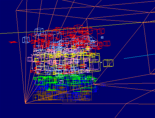
The Mining Engineering Department at the South Dakota School of Mines and Technology has been very successful with the approach to training in computerized mine design. A virtual mine (V MINE) is a hard-rock skeletal mine model being used to teach students design concepts. V MINE has been developed using Vulcan software.
Viewing V MINE in Vulcan is accomplished using 'the walk' option. The speed of the walk and the direction of the view can be changed as the walk continues. The user can view the data in all directions (forward, backward, left, right upward and downward). Relevant information about the project can be accessed by 'clicking' on various objects which are hyper-linked to the data base of the project.
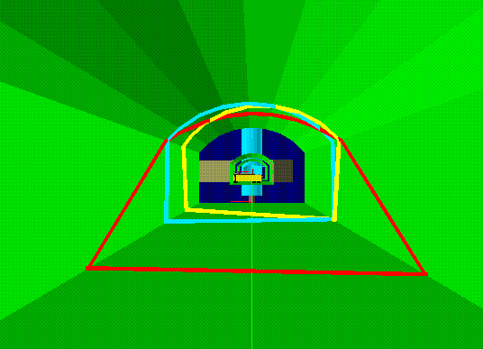
At present, touring V MINE on Internet will be accomplished by looking at still frames. Unfortunately, much of the 3D effect will be lost.
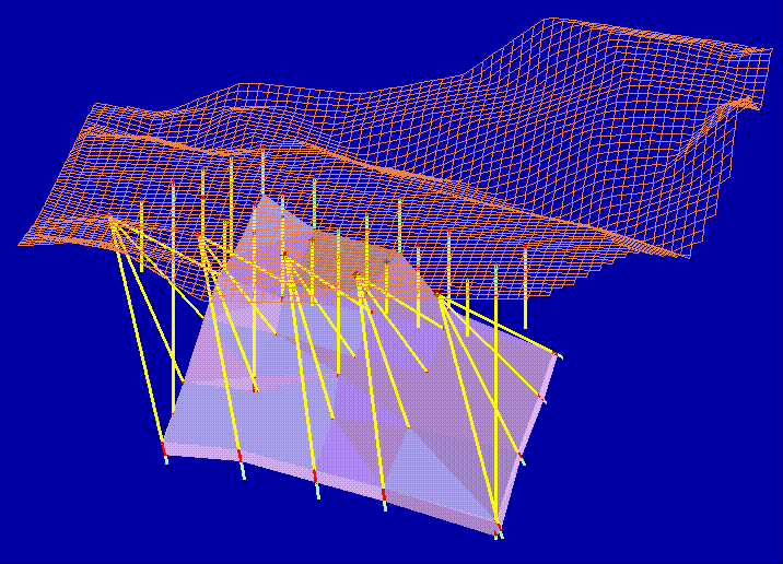
Figure A presents an ore body as revealed by exploration drill holes. The ore body is shown with reference to surface topography represented by its grid model. The ore body solid triangulation and drill hole data base were used to develop a block model from which the reserves grades (interpolated and predicted) were determined.
Figure B presents the mine layout at its initial stage of development. It also shows its relation to the topography and surface infrastructure.
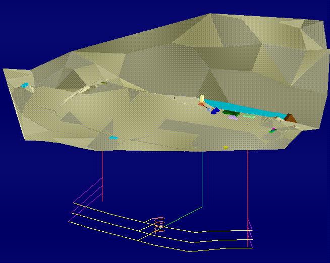
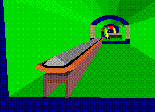
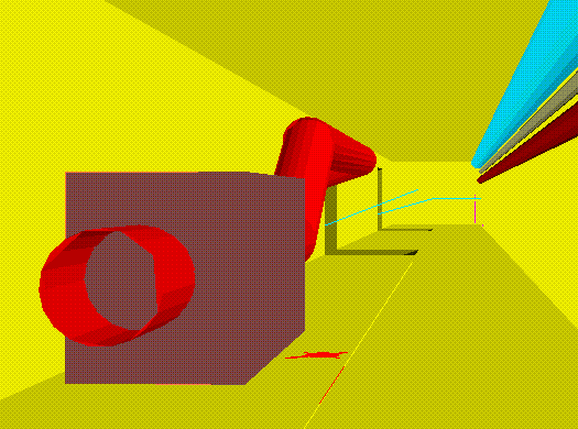
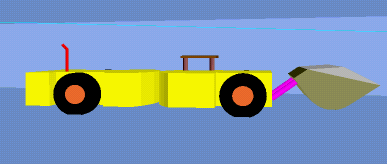
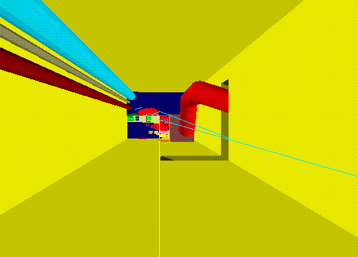
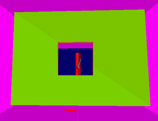
You are invited to tour this mine by viewing a series of snapshots taken during the real tour in Vulcan environment. The tour will simulate the effect of air flowing through the mine. Imagine that you are a particle of air. You will flow above the surface ( on the right side of the property), then you will enter the main intake shaft, travel down the shaft, enter the main haulage drift at the bottom mine level, enter the ramp, travel up the ramp to the next higher mine level, make a right turn and travel through the main drift parallel to the ore body. Then you will visit a stope, enter a ventilation (return air) drift, and enter the exhaust ventilation shaft. Finally, you will leave the mine through the diffuser of the main ventilation fan and you will appear again on the surface.
All objects you will see carry some engineering properties such as: real dimensions, equipment specifications, ventilation requirements, ground support capacities, etc. Some of the objects that make up the mine were removed or made transparent for better visibility and virtual reality effect.
Enjoy the tour!
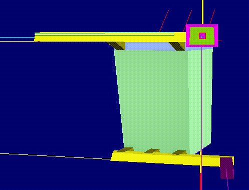
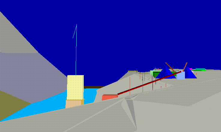
Snapshot 1. Surface infrastructure with the main intake shaft at the end of the pond. Notice the processing and storage facilities, administration buildings and warehouses, access roads, and power lines.
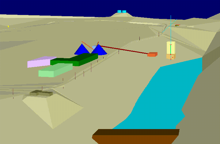
Snapshot 2. Entering the hoist house. Notice the friction hoist and shaft collar.
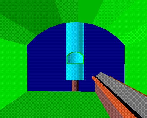
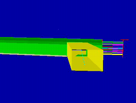
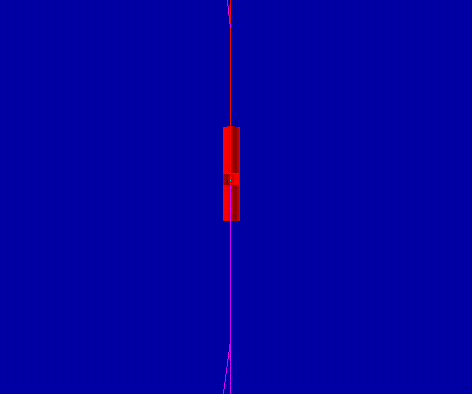
Snapshot 3. Entering the shaft. Notice the skip (two 17 tons bottom dump skips working in balance, traveling at 31 ft/sec.) and the hoist rope (2 1/8 in. flattened strand, 9.1 lb/ft, 240 tons of breaking strength).
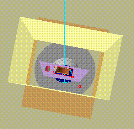
Snapshot 4. Side view of the shaft collar (stepped down, 9 ft thick, 10000 psi reinforced concrete) and the skip. Other objects were removed for better visibility.
Snapshot 5. Approaching the shaft bottom and the intersection with the main haulage level after traveling 2500 ft down the shaft.
Snapshot 6. The main haulage drift with a belt conveyor (36 in., 600 ft/min, 500 tons/hr)
Snapshot 7. Looking back toward the main shaft and the sump.
Snapshot 8. The main haulage drift with an LHD (Wagner Scooptram, 6 cub.yards bucket, 20 ft turning radius, 12000 cfm - ventilation requirements).
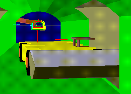
Snapshot 9. Front view of what's ahead: foreground - ramp system and block model of a stope; background - upper level drift with rock bolts shown.
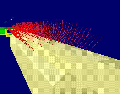
Snapshot 10. Back view section of the main haulage drift showing intercepts of the drift with the geologic structure of the rock mass represented by three joint sets (dip direction/dip: 232/10, 205/81 and 099/70).
Snapshot 11. A section of the drift showing its profile with a drainage ditch.
Snapshot 12. Approaching the intersection of the main haulage drift with a ramp.
Snapshot 13. Looking up to the next level.
Snapshot 14. Looking up and to the right to see a rock bolting pattern.
Snapshot 15. Looking through the ramp's wall: A block model of the stope's reserves - 69837 tons of ore containing 20824 ounces of gold with the average grade of 0.298 oz/ton (min: 0.141, max: 0.661) and 2440 tons of waste.
Snapshot 16. Approaching the upper drift. Notice the concrete reinforced section of the drift, covered ditch containing hot water drainage pipes, and floor rock bolts.
Snapshot 17. Looking back.
Snapshot 18. Blasting pattern for the continuing excavation of the drift
Snapshot 19. Side view of the drift's blasting pattern.
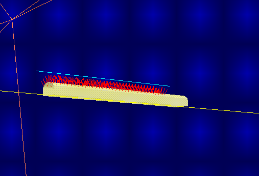
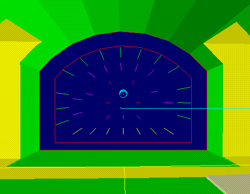
Snapshot 20. Primary rock bolt pattern: 1.5 in. expansion shell bolts, 12 tons capacity, rock mass quality - RMR = 66, stand-up time - 2 weeks.
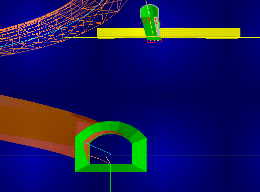
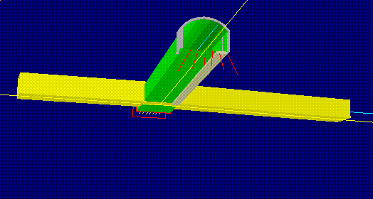
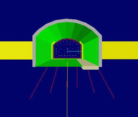
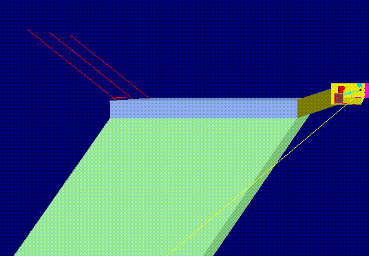
Snapshot 21. Looking straight ahead from the drift running parallel to the ore body at its foot wall. In the background: the VCR stope, the upper and lower sills and the cross-cuts. In the foreground: an exploration drill hole.
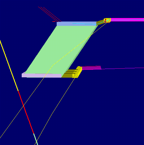
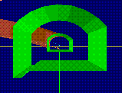
Snapshot 22. Approaching the top sill of the stope. Notice the cable bolts (1.5 in. stranded wire rope, 60 ft long, 100 tons capacity).
Snapshot 23. Entering the top sill area. Notice the auxiliary fan (12.5 kcfm) and 2 ft ventilation flexible tubing (K = 20); electric cable, compressed air line and water pipe.
Snapshot 24. An LHD in the top sill (Wagner Scooptram, 3 cub.yards bucket; 7500 cfm - ventilation requirements).
Snapshot 25. Leaving the top sill area - back view.
Snapshot 26. Approaching a regulator in the return air ventilation drift. Regulator's area: 15.9 sq.ft; resistance: 3.48 PU.
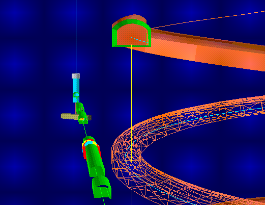
Snapshot 27. Approaching the ventilation exhaust shaft.
Snapshot 28. Back view of the regulator and the stope - as seen from the ventilation shaft.
Snapshot 29. Looking to the right - toward the ramp system before taking a ride up the ventilation shaft.

Snapshot 30. Looking at the surface facilities from the main exhaust fan (Joy 1000 Axivane with a diffuser; 66.7 kcfm at 2.15 in. of head). Note that this last view is opposite to the first view of the tour (snapshot 1).
The V MINE presented here is only the first step to what may soon be common tool for the mining engineer. The 3D design work, geologic interpretation and the reserve model were completed in Vulcan. All other components and analyses (stability, ventilation, economics, mining method and equipment) were conducted externally either utilizing other software packages or manual calculations.
DESIGN PARADIGM
Computerized design guidelines must emulate the real way the mine planners do their jobs. Then, the software pieces must be integrated according to the guidelines. The existing software is incongruent with this requirement.
The material presented in this section combines accepted principles with a new structure and framework needed to successful approach of computerized mine design.
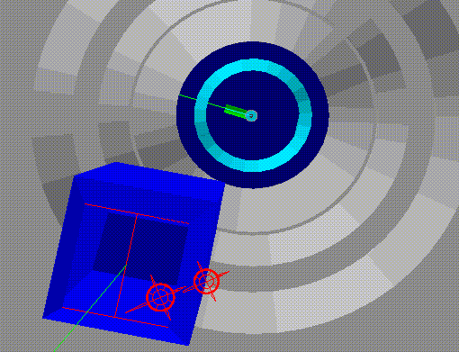
Recognizing the fact that mine design process takes place in 4D conditions, the design guidelines and the flow of information will be presented as a 4D flowchart utilizing 'a box within a box' principle. The entire structure is fractal, repeating its organization on lower levels. The 4D flowchart can be regarded as graphical user interface combining object oriented design, networking and 4D graphics in a virtual reality environment.
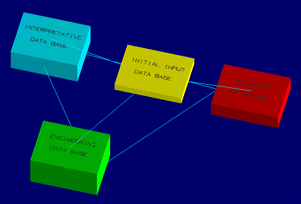
The basic shell is shown in Figure 1 with four 'boxes' representing four data bases. It can also be though of as four decision centers. Most project decisions are made at those four levels. The data bases are connected with each other. There are no arrows -- that show the direction of the flow in traditional flowcharts --only links, with the information flow in all directions. In other words, the activities specified by these four decision centers are conducted simultaneously during the entire design process and continue through the life of the mine.
Figure 1
The content of the Initial Input Data Base is shown in Figure 2. Project Definition defines the scope of work through the goal of the project, the objectives required to fulfill the goal, and the design criteria that will be used to accomplish the necessary activities. The Project Definition is placed on the top of the organizational structure because it is the most important element that would have to be specified before any design activity will take place. Project Definition content is continually checked against the budget before any design decision is made. It is empty now; the user would have to fill it with initial information.
Figure 2
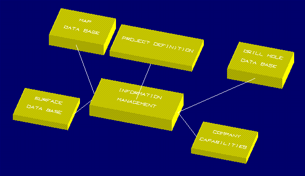
The Information Management distributes the information (in a computerized format) to and from the following four areas that are needed before any design activity is undertaken:
The Map Data Base contains 2D information in the form of: topographical maps, geological maps, geological sections, geophysical surveys, site plans, geotechnical maps, point samples and point observations.
The Drill Hole Data Base contains 1D information in the form of: drill hole intercepts, samples (variables), structural features and geophysical logs.
The Surface Data Base contains information about location of the mining property, its description, access and infrastructure
The Company Capabilities module contains information about available capital, "know how", internal policies and design philosophy.
The Information Management distributes the information to all entities with different level of access decided by the company's management and implemented through the system's administrator
The content of the Interpretative Data Base is shown in Figure 3. The Geologic Volumes are represented by 3D solid triangulations and 2D surface triangulations. The Geologic Structure contains information such as location and orientation of joints, faults and other discontinuities. Both Geologic Volumes and Geologic Structure are used to apply hard boundaries on the Grid Data Base to determine Reserves.
Figure 3
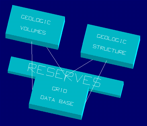
The Grid Data Base contains information about the variation of variables such as: grade (metal), density (bulk handling), BTU (coal), ash content (coal), rock/soil contaminant concentration (environmental), ground water contaminant concentration (environmental), rock mass quality (ground control) and hydraulic conductivity (ground water flow). It also contains suitable predictive tools such as geostatistics.
The end product from interpretations and modeling is the Reserves that specifies the information in the form of: amount, tonnage, grade, BTU (coal) and uncertainty.
The Interpretative Data Base is not only needed to be determined in great detail before the design starts, but it must be also continually updated until all reserves are actually mined out.
The Engineering Data Base is shown in Figure 4. This is the area where the creative part of the design begins. Design starts from the lowest level of this fractal structure. Design is the creative activity while all the necessary information is the design context (the conditions and circumstances affecting the design). There are two distinct design activities: mining and development. While in reality the main access openings are constructed first, followed by the development in the ore body to set up a mining face, the design process actually follows a reverse order. Because a mine face is the focal point of all activities, the mining faces are designed first, followed by the design of necessary development and service excavations to handle the production, power, supplies and ventilation. The main access openings such as shafts are usually designed last.
Figure 4
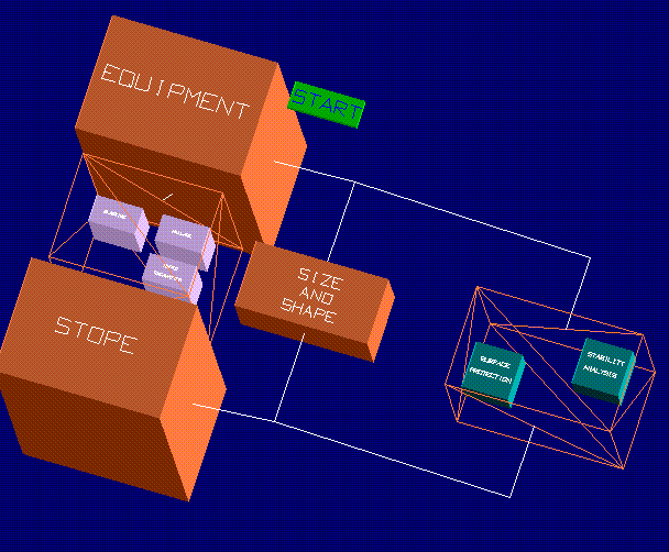
The Mining module is shown in Figure 5. After all necessary initial information have been collected and interpreted, the equipment sizing is the first to start with. This notion is represented by the �Start� button attached to the equipment.
Figure 5
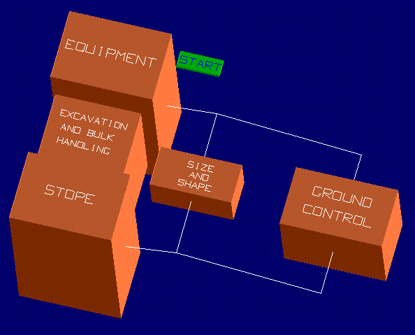
The start button carries very important design aspects. It conveys the scope of work (see the Project Definition in Figure 2). Since the geo-engineering conditions vary throughout the ore body, the planning engineer would have to 'press the start button' every time the conditions change, with a new scope of work content and therefore a new context. New conditions are usually specified for the mineable reserves parceled out into zones distinguished by mining methods.
The start button is a dynamic entity that is actually floating within the 4D diagram. Depending on the design context it can be attached to any low level component of its fractal structure. For the engineer, it represents a mechanism of engineering heuristics to discover and implement the engineer's own way of handling the design This is, in fact, an instrument incorporating design flexibility and engineering heuristics into a computerized format.
Furthermore, the start button expresses an important connotation. It indicates the way the new software components, such as analyses and simulations, should be integrated, and prioritizes their development. Of course, not everything can be implemented at once, but developing new software and expanding the existing software in a haphazard way, as it is being done today, does not seem to be very effective in mine design. Expanding the computerized system according to a structured model emulating the real design process, seems to be more promising. The current location of the start button shows the most needed areas of software integration.
The design starts with equipment selection and sizing. The required input is: production (from the Initial Input Data Base), mining method (selected externally), and equipment specifications (available from the equipment library) The equipment that meets the production requirements is then checked against the stope geometry (designed in 3D graphics editor). Usually, multiple stopes are designed to meet the production. The equipment sizing and stope design are controlled through the size and shape aspect, and ground control. The process resembles an iterative mode, but in fact all these factors are being taken into consideration simultaneously.
The input required to size the stopes, within a particular mining zone, flows from the Interpretative Data Base (Figure 3) and is available in the form of the reserve model (grid data base) and geology (geologic volumes and geologic structure). The interactive design process may generate a feedback flowing back to the Interpretative Data Base in the form of the new drill hole request.
The input for Ground Control includes the stress field (principal stresses -- possibly determined in situ) and rock mass properties (failure criteria and material constants). The ground control would call, at this point, for stability analysis (empirical in combination with numerical such as Finite Element Method) from which the final stope geometry and, in turn, the new equipment size can be determined (Figure 6). Moreover, stability analysis includes any artificial support needed for rock reinforcement. Caving mining systems would also include surface subsidence prediction.
Figure 6
Once the equipment and the stopes have been sized, the design continues through the process of developing the first system -- excavating and bulk handling -- representing the primary objective of mining and being a foundation for all other subsystems. This system includes all pieces of equipment needed for excavating the ore, loading and hauling. The choice would have to be made between conventional blasting techniques (design of blasting patterns) or rapid excavation (TBM, roadheader, etc.) The excavation and bulk handling system would also address the main haulage type (LHD, loader and truck, conveyor or rail), and how the ore, waste and supplies will be handled. Since the scope of the project is influenced by the budget and vice versa, important preliminary financial decisions would have to be made at this point. A direct link with the Economic Data Base is essential.
The basic output from the Mining module is used to create the Primary Development Layout in the form of a network of centerlines for the future development openings (Figure 4). The Primary Development Layout will specify the layout for the deposit recovery and will include the main levels for haulage and personnel access, main shafts and ramps, and sublevels organized into zones associated with mining methods selected.
The Development module is shown in Figure 7. At first, it looks similar to the Mining module, but there are some important differences. All drifts and main access openings are dimensioned for a specific purpose, usually to accommodate the equipment. The relation between the equipment and the opening can be handled in two ways: one is to design the drift profile (size and shape) around the selected machine (plus required clearances and room for utilities); the other is to fit a machine into already available drift.
Figure 7
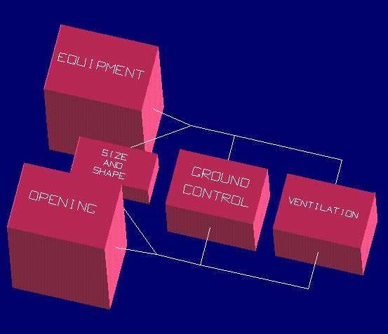
When designing a new mine the drifts are first dimensioned for the equipment and then are checked against the ground control and ventilation requirements, which in turn may require again modification of the drifts� geometry (both size and shape).
Required input for equipment/opening sizing is: advance rates and applicable geometry (from the Initial Input Data Base), and equipment specifications (from the equipment library).
The input for Ground Control includes the stress field (principal stresses -- possibly determined in situ) and rock mass properties (failure criteria and material constants). The stability analysis, including the reinforcement, would involve empirical design (Rock Mass Rating) in combination with the numerical approach (Finite Element Method).
Ventilation needs are specified by the required quantities of air and required velocities of air (for both the development phase and after the drifts will become a part of the ventilation network in the operating mine).
The sizing process goes through iterations until the equipment, the opening�s geometry, the ground control and the ventilation requirements match. Sizing of the openings will include all other excavations needed for normal mine development such as ramps, raises, cross-cuts, etc.
The initial access openings such as shafts (or main access ramps) need special attention. Shaft sinking needs a complete set of special equipment and is usually treated as a special project assigned to a specialized company (shaft sinking contractors). Most of the initial requirements for the shafts, however, are specified during this phase of the design.
The output from the Development module flows to the Primary Development Layout and back to the Mining module for updating and modifications.
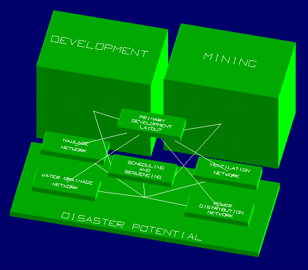
The Primary Development Layout (Figure 8) is the basis for sequencing and scheduling in which specific advance rates are applied, for both the construction and the production. It eventually evolves into a complete mine layout in the four dimensional virtual time - space. It is also a backbone network from which four operational networks (haulage, power, ventilation and drainage) are developed.
Figure 8
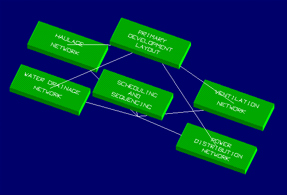
Once the four operational networks are created, a series of analyses would have to be conducted (Figure 9): ventilation network analysis, production analysis for the equipment. haulage simulations, power distribution analysis, ground water flow analysis and water drainage analysis.
Figure 9
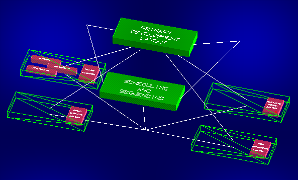
Each network analysis would have to be specified in precise terms applicable to a particular mining situation. For example, the ventilation analysis may include any or all of the following items: volume flow, mass flow, heat exchange (air conditioning) and fire simulation.
Advantages of computerized integration of the mine layout with the operational networks are tremendous. Any change in any of the networks will indicate necessary changes in others. The mine layout is a planning tool that is used not only to design and coordinate operational networks, but also to integrate all structures and activities to support the mine. It extends all the way back to the surface and is connected to all necessary surface infrastructure such as: access roads, transportation facilities, power lines, mineral processing facilities, bulk and explosive storage facilities, warehouses, hoist houses, administration buildings, waste water treatment facilities, etc.
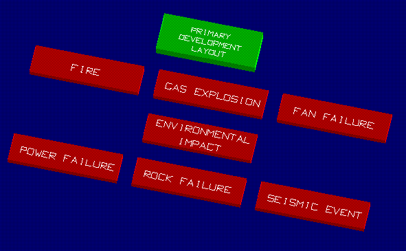
The Mine Layout and associated Networks can be effectively utilized to create a hypothetical Disaster Potential or �what if?� scenarios. It is imperative for the mining engineer to know what to do in case of unexpected events (Figure 10). For example, in case of fire: the ventilation network can be subjected to simulations and the results then can be used to develop an escape plan, rescue procedures and the location of refuge stations. Furthermore, if one can envision the described networks available to mine personnel for viewing, the safety and the employees� morale can be significantly improved.
Figure 10
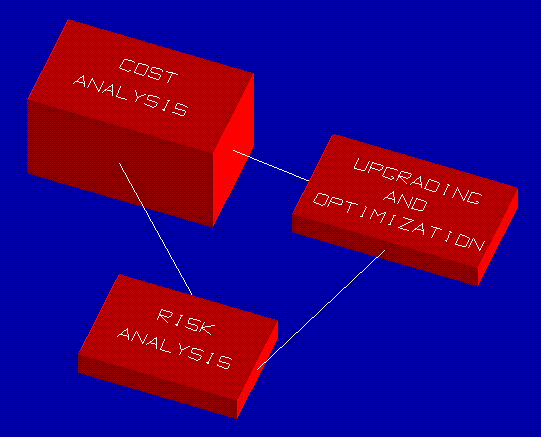
The Economic Data Base is shown in Figure 11. The cost analysis includes: capital costs, processing costs and transportation costs. Standard analyses include: cash flow, break-even and sensitivity. The cost analysis, upgrading and optimization will determine profitability of the entire operation. The profitability and risk analysis will then be used to justify the final decisions before the implementation.
Figure 11
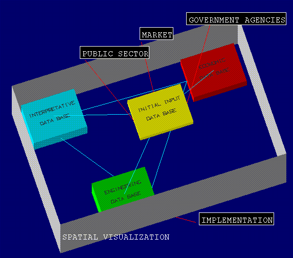
One of the most important aspects of the presented design paradigm is the spatial visualization of its elements (Figure 12). The virtual reality environment surrounds the data bases and extends far beyond the engineering design content. The link to the Implementation provides important relationships with the management, organizational structure of the company, personnel and training. Other possible links are equally important. Government agencies impact the design process through federal, state and local regulations the mining operations must fulfill. Perhaps the permitting process could be handled better if the engineering content was presented in a visual format. Moreover, if some of the visualization, such as simulations of the environmental effects, was made available to the general public, public perception of mining could possibly change to more positive.
Figure 12
The presented mine design paradigm is a conceptual design model that would guide the user in the design process and would integrate pieces of software in harmony with the design components. Its open architecture would allow the engineer to modify its structure, if needed, allowing for design flexibility.
CONCLUSIONS
A modern and cost effective mine design and planning process should be based on a computerized model that could be tested before its implementation. The leading software developers would have to re-engineer their software and include an adequate design paradigm. These developments should be done in partnership, not only with the mining industry, but also with the educators to meet the future demand for creative problem solvers.
REFERENCES
Basu, A. J., Lineberry, G. T., Unrug, K. F. 1991. A skeletal model for an intelligent and integrated design system for underground coal mines. SME Annual Meeting, Denver, Colorado, Preprint No. 91-73
Britton, S. G. 1985. Strategic planing for efficient underground mine design. SME Fall meeting, Albuquerque, New Mexico, Preprint No. 85-304.
Freeman, L. W. 1996. Creating wealth in a changing environment. Mining Engineering, June, pp: 62 - 65.
Gehring, D. R. 1996. Practical Elements of project management for underground construction. Mining Engineering, April, pp: 40 and 41.
Hladysz Z. J 1994. Working with Vulcan - A training manual for underground mine design. Rapid City, South Dakota.
Hladysz, Z. J. 1994. Computerized mine planning. Proceedings of The Fifth Western Regional Conference on Precious Metals, Coal and the Environment, Lead, South Dakota, Coal session pp: 30 - 48.
Hladysz Z. J. 1996. Students must use modern design tools. Mining Engineering, June, pp: 11 and 16.
Hobbs, B. E., Henley, S. 1995. Computing for the exploration and mining industries to the year 2000. APCOM XXV, Brisbane, Australia.
Holding, S. W. 1994. 3D Geoscience Modeling. Springer-Verlag, New York.
Lineberry, G. T., Adler, L. 1987. A mine design procedure for underground coal. SME Annual Meeting, Denver, Colorado, Preprint No. 87-48.
Lineberry, G. T., Paolini, A. P. 1992. Equipment selection and sizing. SME Mining Engineering Handbook, pp: 1550-1571.
Luxbacher, G. W., Kline, R. J. 1992. Mine planning and design. SME Mining Engineering Handbook, pp: 1544-1549.
McDonald, D. 1994. Mining - computing - past, present and future. Proceedings of the 90 th Meeting of The Rocky Mountain Coal Mining Institute, Snowmass Village, Colorado, pp: 32-36.
Moser, P., Oberndorfer, T. 1995. Accessing underground hardrock mines. SME Annual Meeting, Denver Colorado, Preprint No. 95-54.
Pazdziora J. 1988. Design of Underground Hard-Coal Mines. Elsevier, New York.
Richards, S. A., Barna, S. L. 1994. Efficient planning models for underground coal mines. SME Annual Meeting, Albuquerque, New Mexico, Preprint No. 94-157.
Sturgul, J. R. 1995. Simulation and Animation - Come of age in mining. Engineering and Mining Journal, October.
This paper was presented at the First International Symposium on Mine Simulation via the Internet, MINESIM '96 at National Technical University of Athens, Greece, December 3 to December13, 1996.